Welcome back to #TravelThursday. A couple of months ago I visited The Ringling estate in Sarasota Florida. It was another field trip with the Sebring Historical Society – the group that I serve with. I was with a group of about 30.
Our chartered bus departed from the parking lot of our museum at 8:43 AM. The drive to the Gulf Coast took a little less than 2 hours. Our first stop in Sarasota was Der Dutchman – a large Amish-style restaurant, bakery, and gift shop. At the restaurant you can either order off the menu or enjoy the buffet. (Our “all-inclusive” trip included the buffet.) We arrived there as Breakfast was wrapping-up and Lunch was just getting started. Some in our group enjoyed a late-Breakfast. I enjoyed a hearty Lunch. It was all good. I think my favorite dish was their slow-cooked old-fashioned Roast Beef. It was quite delicious and juicy. We spent over 2 hours there eating, browsing, and shopping.
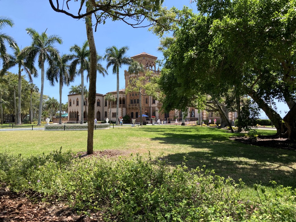
Our next stop was the Ringling estate. We spent 3 hours there, and our group pretty much split-up to tour the museums and grounds at our own individual paces. I visited much of the estate to include both circus museums and Ca’ d’Zan (“House of John” in Venetian) – John and Mable Ringling’s personal residence (built from 1924 to 1926) overlooking Sarasota Bay.
My favorite part of the circus museum was the 38,000-square-foot / 42,000+ piece miniature circus display that was essentially a ¾-inch-to-the-foot scale (1:16) model of a typical 24-hour day in the life of the Ringling Brothers And Barnum & Bailey Circus during the 1920s and 1930s. I think that was probably my favorite part of the entire estate. I did a walkthrough at the beginning of my visit, but there were so many other people doing the same thing that I couldn’t fully enjoy it, so I returned a couple of hours later to check it all out again in greater detail with far less people around. Circus fan Howard Charles Tibbals designed and built the model from 1956 to 1974 (age 20 to 38). It premiered at the World’s Fair in Knoxville Tennessee in 1982. He set it up at its current location at the museum in 2004 and 2005. What an amazing accomplishment to build that miniature circus !
We got back to Sebring after 6 PM. It was a fun day out with my historical society friends. It was revealed that our next field trip will be in just a couple of weeks – a 4-hour St. Johns River cruise out of Sanford Florida with a big multi-course lunch and a comedy play. I’m looking forward to it !
Next #TravelThursday – What do Sebring Florida and Chattanooga Tennessee have in common ? Let’s keep traveling together.
All rights reserved (c) 2024 Christopher M. Day, CountUp
