Categories
Animals Blogging Geography History Military Nature Photography Travel

Village Between The Lakes

Welcome back to #TravelThursday. Last week I wrote about the other Savannah – the one on the Tennessee River known as the “Catfish Capital Of The World”.

Continuing downstream on the river on my upcoming American Cruise Lines paddlewheeler ship cruise – it’s Grand Rivers Kentucky down in the southwestern corner of the state. It’s about 167 miles downstream from Savannah, and the journey is scheduled to take about 17½ hours, for an average speed of about 9½ MPH. There is no elevation drop between Savannah and Grand Rivers, as the entire journey is actually on Kentucky Lake – created by Kentucky Dam at Grand Rivers. At 160,309 acres it is the largest artificial lake by surface area in the U.S. east of the Mississippi River.

I’ll be part of a 3-hour-plus shore excursion that afternoon in Land Between The Lakes – the federally-protected national recreation area between Kentucky Lake (Tennessee River) and Lake Barkley (Cumberland River). Our first stop will be the Woodlands Nature Station. Our next stop will be the Elk & Bison Prairie.

Paducah Kentucky (“Quilt City U.S.A.”) is another option on this day while docked in Grand Rivers. It’s about a 30-minute luxury coach ride into downtown, and then you’re on your own to do your own thing there for up to 3 hours before the coach returns back to the ship.

That night back on the cruise ship we will officially transfer over from the Tennessee River downstream to the Cumberland River upstream. (Both rivers flow into the Ohio River.) The 1.75-mile Barkley Canal essentially acts as a short-cut between the two rivers near their closest approach to allow vessels to bypass the Ohio River some 22½ (Tennessee) to 30½ (Cumberland) miles downstream. The Barkley Canal was built by the U.S. Army Corps of Engineers (USACE) from the late-1950s through the mid-1960s. It was completed and filled in 1966. The water depth runs from 11 to 15 feet depending on rainfall.

Once on Lake Barkley our 22-hour journey upstream on the Cumberland River begins. The river narrows into a traditional river and winds its way southeastward towards downtown Nashville, and that’s where I’ll be – next – #TravelThursday. Let’s keep traveling together.

All rights reserved (c) 2026 Christopher M. Day, CountUp

Categories
Blogging Food Geography History Military Nature Photography Travel

Catfish Capital Of The World

Welcome back to #TravelThursday. Last week I wrote about Florence, Muscle Shoals, Sheffield, and Tuscumbia Alabama – collectively known as “The Shoals” locally.

Downstream the Tennessee River from The Shoals by about 66 miles is Savannah Tennessee – “Catfish Capital Of The World”. It’s the next port-of-call on my upcoming American Cruise Lines paddlewheeler ship cruise. It’s about 55 to 60 feet lower in elevation than Florence Harbor, so less than a foot every mile on average. But nearly the entire drop actually occurs at the lock at Pickwick Dam – 17 miles before (upstream from) Savannah. That will be an early-morning 45-minute drop in the “elevator”, as we are scheduled to arrive in Savannah by 7:30 AM – about 40 minutes after sunrise.

I’m booked on a couple of shore excursions that day in Savannah. In the morning I’ll be touring the historic Shiloh National Military Park about 10 miles southwest of Savannah. It was the site of the American Civil War Battle Of Shiloh (AKA Battle Of Pittsburg Landing) on April 06TH and 07TH of 1862. It was established as a National Military Park 32½ years later on December 27TH 1894. President Grover Cleveland signed it into law. It was transferred from the Department Of War to the National Park Service effective August 10TH 1933 by President Franklin Delano Roosevelt.

So you’re wondering about the catfish. The stretch of Tennessee River adjacent to Savannah is known for its abundance of various types of catfish of all sizes – including some really big ones in the 60 to 80 pound or more range. Catfishing anglers come to Savannah each Fall (September and October) to participate in various tournaments. The locals welcome the visitors, as the city celebrates with pageants, parades, and fish fry gatherings along the river.

As for Savannah itself – it was settled 200 years ago during the 1820s. It was originally named Rudd’s Ferry – named after – well – James Rudd (an early settler) – and his ferry across the Tennessee. His wife was Elizabeth, and she was originally from Savannah Georgia. In 1830 – Rudd’s Ferry was renamed to Savannah Tennessee so that Elizabeth could still live in a town named Savannah. Nowadays over 7,000 residents call Savannah home, and over 28,000 residents live in surrounding Hardin County (including Savannah).

Next #TravelThursday – I’ll write about Grand Rivers Kentucky – where two rivers almost but not quite converge. Let’s keep traveling together.

All rights reserved (c) 2026 Christopher M. Day, CountUp

Categories
Blogging Driving Geography Nature Photography Travel

The River City & The Rocket City

Welcome back to #TravelThursday. Last week I wrote about Chattanooga Tennessee. About 167 miles downstream the Tennessee River is Decatur Alabama (“The River City”) – one of the ports-of-call of my upcoming American Cruise Lines paddlewheeler ship cruise on the Tennessee and Cumberland Rivers. And just up the road (I-565) by about 25 minutes is Huntsville Alabama (“The Rocket City”). I’ve been to Huntsville twice before in 1990 and 1992 for quick visits to pick-up my brother from Space Camp / Space Academy at the U.S. Space & Rocket Center.

It’s a quick 5½-hour afternoon docking at Rhodes Ferry Park in Decatur. I’m booked on a shore excursion over at the Huntsville Botanical Garden. I’m looking forward to exploring 118 acres of nature. Longtime readers of #TravelThursday (and its various predecessors online) know that I’m a big fan of botanical gardens and related nature parks. They make for great photo opportunities – plus – I like learning more about trees, plants, and flowers. If I had stayed down in South Florida for retirement – there’s a good possibility that I would’ve been at the Fruit & Spice Park often – possibly even as an employee or a volunteer.

Fun Fact # 1: The Tennessee River in Decatur Alabama sits at an average elevation of about 555 feet above sea level, or almost 80 feet lower than Chattanooga Tennessee. That’s how the river flows downstream. #Science

Fun Fact # 2: Huntsville is Alabama’s largest city, and one of the fastest-growing cities in the U.S.A. Its population is approaching 250,000. Back in 2010 it was Alabama’s 4TH largest city, but it has since surpassed Birmingham, Montgomery, and Mobile. (Mobile is now # 2 – having also surpassed Birmingham and Montgomery.) Over 550,000 residents live in the Huntsville metro area (Madison and Limestone Counties).

Next #TravelThursday – I’ll write about Florence Alabama. Let’s keep traveling together.

All rights reserved (c) 2026 Christopher M. Day, CountUp

Categories
Blogging Driving Food Geography Nature Photography Travel

The Scenic City

Welcome back to #TravelThursday. This week I’m writing about Chattanooga Tennessee. I’ve only been there once – back in August 1992 with my brother. We were on a road-trip from Huntsville Alabama to Atlanta Georgia by way of Tennessee. We spent the night in “Chatt” after crossing The Great Smoky Mountains earlier in the day via U.S. 441 (Newfound Gap Road).

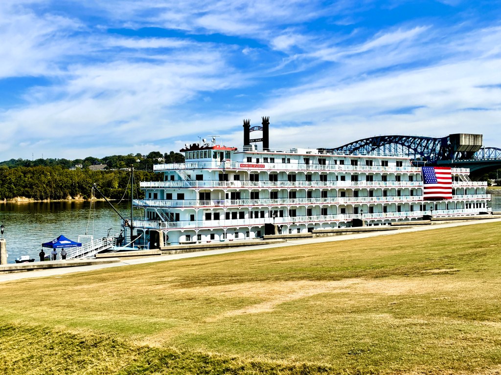
34 years later I’ll be visiting Chattanooga for the 2ND time in my life, and I’ll be spending a single night at a hotel (just like the first time). The next morning I’ll be at Ross’s Landing to board my American Cruise Lines paddlewheeler ship with about 180 fellow passengers. It’s about a 15-minute walk from the hotel that the cruise passengers will be staying at the night before embarkation. (We’ll actually get a luxury coach bus ride over to the ship with our luggage.)

If my plane arrives on time (or earlier) at Chattanooga Airport (#CHA) then I should have about 4 hours of daylight in the afternoon and evening to check out the downtown area and riverfront (and also eat dinner). I hear that City Cafe Diner is a good place for any meal at any time.

Fun Facts: U.S. 27 runs right through downtown Chattanooga about 670 miles north of my home (which is also located along the historic route). Chattanooga is a border town, as its southern city limits straddles the Tennessee / Georgia State Line. Chattanooga shares the border with the city of Rossville Georgia. Much of downtown Chattanooga sits at an elevation of about 620 feet (along the river) to about 680 feet. Southwest of downtown elevations climb substantially to about 2,369 feet above sea level along the slopes of Lookout Mountain.

Next #SundayScripture – I’ll share more about my visit to Homestead Florida last weekend. Check it out on Sunday here at revchrismday.com.

Next #TravelThursday – I’ll write about Decatur and Huntsville Alabama. Let’s keep traveling together.

All rights reserved (c) 2026 Christopher M. Day, CountUp